
Military & AI
Weather Is a Military Input: NASA, NOAA and the Dual-Use Satellites Behind Every Forecast
NASA has long built NOAA's weather satellites, but in 2025 the division behind the linked page was removed from that work. How GOES, JPSS and GeoXO fit together, how military weather satellites split off and still share data, and why AI forecasts make the observing system strategic.
 Akmal Alif · 10 October 2026 MYT
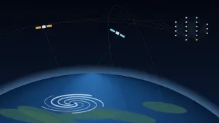
The page behind this post is NASA's listing for the NOAA work of its Joint Agency Satellite Division (JASD). Today it is a short news index whose one story is GOES-U, a NOAA weather satellite, arriving in Florida for launch processing (NASA, n.d.). Behind that page sits the arrangement that has built America's civil weather satellites for decades, and it changed in 2025.
This post explains that arrangement and why it belongs in Military & AI. The same orbiting instruments feed civilian forecasts and military weather operations. They also feed the AI models that now produce forecasts at a fraction of the old computing cost.
Who builds America's weather satellites
NOAA operates the United States' civil weather satellites, but for most of their history NASA has built and launched them. NOAA pays NASA through reimbursable agreements. The 2020 National Space Policy says NOAA may use NASA as the acquisition agent for operational environmental satellites (NOAA & NASA, 2025).
On NASA's side, JASD, a division of the Science Mission Directorate at NASA Headquarters, oversaw this work. The programmes themselves were run at the Goddard Space Flight Center.
That changed in 2025:
August 2025. A memo from NASA's Associate Administrator moved NASA's authority over the joint programmes from Headquarters to Goddard on 12 August 2025.
September 2025. A new NOAA–NASA management plan, signed on 17 September, called this a significant change in governance. It removes the Science Mission Directorate and JASD from oversight and management of NOAA programmes.
Acquisition. Either agency may now run an acquisition, rather than NASA being assumed as the buyer. NOAA's satellite office approves every acquisition strategy.
One exception. The only programme left under the old arrangement was the SWFO-L1 space-weather mission, then still before launch (NOAA & NASA, 2025).
The plan says the change responds to 2025 Administration direction to streamline processes and management. NASA's science.nasa.gov page for JASD now returns a "page not found" error, though the nasa.gov listing linked above is still online. Read it as an archive of a structure that has since been reorganised.
The satellites
GOES-R series, geostationary. These satellites watch the Americas continuously from 22,236 miles up. GOES-U launched on 25 June 2024 on a Falcon Heavy from Kennedy Space Center. It reached geostationary orbit on 7 July and was renamed GOES-19 (NOAA NESDIS, 2024). On 7 April 2025 it took over as GOES East, replacing GOES-16, which became the backup (NOAA NESDIS, 2025).
JPSS, polar-orbiting. NOAA-20 (2017) and NOAA-21 (2022), with the older Suomi NPP (2011), circle pole to pole. Their sounders measure temperature and moisture through the depth of the atmosphere, a key input to global forecast models.
GeoXO, the next geostationary system. The original plan was six satellites with five instruments at an estimated $19.6 billion. In April 2025 a White House budget passback directed NOAA's satellite office to immediately cancel all major GeoXO instrument and spacecraft contracts. Congress then required every satellite to carry an imager and a sounder. An April 2026 rebaseline settled on four satellites with launches in 2032, 2034, 2039 and 2043, at a life-cycle cost of $11.9 billion (Congressional Research Service, 2026).
QuickSounder, a pathfinder. The first mission of NOAA's Near Earth Orbit Network is a small satellite carrying one refurbished microwave sounder. NOAA anticipates launch in 2027 (NOAA NESDIS, n.d.).
SOLAR-1, space weather. It launched on 24 September 2025 as SWFO-L1 and reached its station about a million miles from Earth, toward the Sun, in January 2026. NOAA calls it America's first satellite designed exclusively for continuous, operational space-weather observation (NOAA NESDIS, 2026).
The military thread
One programme, then two. Until 2010, America's next polar weather satellites were meant to be a single system, the National Polar-orbiting Operational Environmental Satellite System (NPOESS), managed jointly by NOAA, the Department of Defense and NASA. In February 2010 a presidential task force disbanded it, and NOAA and the military began separate acquisitions. NOAA's became JPSS. The Defense Department's Defense Weather Satellite System was terminated in early 2012 while the department reassessed its requirements (Government Accountability Office, 2012).
The military's own satellites. The Defense Meteorological Satellite Program (DMSP) has flown military polar weather satellites since the 1960s. Its successor, Weather System Follow-on – Microwave (WSF-M), launched on 11 April 2024 from Vandenberg Space Force Base. Its passive microwave radiometer targets three gaps the Defense Department had identified: ocean surface winds, tropical-cyclone intensity, and energetic charged particles in low orbit. It also measures sea ice, soil moisture and snow depth (Robinson-Smith, 2024).
The data flows both ways. In June 2025 the Navy's Fleet Numerical Meteorology and Oceanography Center (FNMOC) announced it would decommission its DMSP ingest system to mitigate a significant cybersecurity risk. NOAA's satellite operations office relayed the notices to civilian users of the data.
A postponement. After a request from NASA, processing was extended to 31 July (NOAA Office of Satellite and Product Operations, 2025a).
A reprieve. On 30 July the center said distribution would continue past that date, on a best-effort basis, as "data of opportunity".
WSF-M. The Defense Department said it was working to send WSF-M data to NOAA as soon as possible (NOAA Office of Satellite and Product Operations, 2025b).
Military models, allied science. Since 1 October 2015 the US Air Force's primary global weather model has been GALWEM, which is based on the UK Met Office's Unified Model (Zapotocny, 2016).
Weather decides whether aircraft fly, whether optical sensors can see through cloud, and how ships and troops move. Space weather can degrade radio links and satellite navigation. That is why military and civil weather systems have never been fully separate: the observations are shared, and so are the models and the people.
Where AI comes in
AI has changed how forecasts are computed. It has not changed where they start.
GraphCast. Google DeepMind's model, published in Science, learned to forecast from decades of ERA5 reanalysis (Lam et al., 2023). ERA5 is a reconstruction of the global atmosphere over past decades, built by combining historical observations, satellite data included, with a physics model (Hersbach et al., 2020).
ECMWF AIFS. The European Centre for Medium-Range Weather Forecasts put its AI system into operations on 25 February 2025. It starts each forecast from the same initial conditions as the centre's physics model, built from around 60 million quality-controlled observations from satellites and other sources (ECMWF, 2025).
NOAA's AI models. On 17 December 2025 NOAA made three AI global models operational: AIGFS, a 31-member ensemble (AIGEFS) and a 62-member hybrid ensemble (HGEFS). All are based on GraphCast (National Weather Service, 2025) and fine-tuned on NOAA's own data-assimilation analyses. NOAA says a 16-day AIGFS forecast uses about 0.3% of the computing of its traditional global model (NOAA, 2025).
Our reading: AI makes running a forecast cheap enough that compute is no longer the scarce part. The observing system is. Every AI forecast, civil or military, begins from an analysis of today's atmosphere, and that analysis depends on satellites like GOES-19, NOAA-21 and WSF-M. That makes them strategic infrastructure in a way the NASA page's quiet news list does not suggest.
What to watch
The new governance. Whether management led from Goddard keeps GeoXO, QuickSounder and the JPSS follow-ons on schedule.
Sharing on paper. Whether civil–military data sharing is put on a firmer footing than "data of opportunity".
Gaps between generations. How the shrinking GeoXO constellation, and any gap between satellite generations, would affect the AI models that now depend on the same data.
References
Congressional Research Service. (2026, July 10). NOAA's Geostationary Extended Observations (GeoXO) satellite program and issues for Congress (CRS Report No. R49026). https://www.everycrsreport.com/reports/R49026.html
ECMWF. (2025, February 25). ECMWF's AI forecasts become operational. https://www.ecmwf.int/en/about/media-centre/news/2025/ecmwfs-ai-forecasts-become-operational
Government Accountability Office. (2012). Polar-orbiting environmental satellites: Changing requirements, technical issues, and looming data gaps require focused attention (GAO-12-604). https://www.gao.gov/products/gao-12-604
Hersbach, H., Bell, B., Berrisford, P., Hirahara, S., Horányi, A., Muñoz-Sabater, J., Nicolas, J., Peubey, C., Radu, R., Schepers, D., Simmons, A., Soci, C., Abdalla, S., Abellan, X., Balsamo, G., Bechtold, P., Biavati, G., Bidlot, J., Bonavita, M., ... Thépaut, J.-N. (2020). The ERA5 global reanalysis. Quarterly Journal of the Royal Meteorological Society, 146(730), 1999–2049. https://doi.org/10.1002/qj.3803
Lam, R., Sanchez-Gonzalez, A., Willson, M., Wirnsberger, P., Fortunato, M., Alet, F., Ravuri, S., Ewalds, T., Eaton-Rosen, Z., Hu, W., Merose, A., Hoyer, S., Holland, G., Vinyals, O., Stott, J., Pritzel, A., Mohamed, S., & Battaglia, P. (2023). Learning skillful medium-range global weather forecasting. Science, 382(6677), 1416–1421. https://doi.org/10.1126/science.adi2336
NASA. (n.d.). NOAA [Joint Agency Satellite Division]. Retrieved October 10, 2026, from https://www.nasa.gov/directorates/smd/joint-agency-satellite-division/noaa/
National Weather Service. (2025, December 9). Service change notice 25-89: Implementation of the Artificial Intelligence Global Forecast System (AIGFS), Artificial Intelligence Global Ensemble Forecast System (AIGEFS), and the Hybrid Global Ensemble Forecast System (HGEFS): Effective December 17, 2025. https://www.weather.gov/media/notification/pdf_2025/scn25-89_AIGFS_AIGEFS_and_HGEFS.pdf
NOAA. (2025, December 17). NOAA deploys new generation of AI-driven global weather models (Updated February 17, 2026). https://www.noaa.gov/news-release/noaa-deploys-new-generation-of-ai-driven-global-weather-models
NOAA & NASA. (2025). NOAA-NASA satellite programs and projects management control plan (MCP) (Version 2.0). https://www.nesdis.noaa.gov/s3/2025-12/NESDIS-PLN-1130-2-september-2025.pdf
NOAA NESDIS. (n.d.). Near Earth Orbit Network (NEON). Retrieved October 10, 2026, from https://www.nesdis.noaa.gov/our-satellites/future-programs/near-earth-orbit-network-neon
NOAA NESDIS. (2024, July 8). NOAA's GOES-U reaches geostationary orbit, now designated GOES-19. https://www.nesdis.noaa.gov/news/noaas-goes-u-reaches-geostationary-orbit-now-designated-goes-19
NOAA NESDIS. (2025, April 7). NOAA's GOES-19 now operational as GOES East, providing critical new data to forecasters. https://www.nesdis.noaa.gov/news/noaas-goes-19-now-operational-goes-east-providing-critical-new-data-forecasters
NOAA NESDIS. (2026, January 27). SWFO-L1, renamed SOLAR-1, reaches final destination one million miles from Earth. https://www.nesdis.noaa.gov/news/swfo-l1-renamed-solar-1-reaches-final-destination-one-million-miles-earth
NOAA Office of Satellite and Product Operations. (2025a, June 30). [Administrative message on DMSP data processing at FNMOC]. https://ospo.noaa.gov/data/messages/2025/06/MSG_20250630_0345.html
NOAA Office of Satellite and Product Operations. (2025b, July 30). [Administrative message on continued DMSP data distribution]. https://www.ospo.noaa.gov/data/messages/2025/07/MSG_20250730_0015.html
Robinson-Smith, W. (2024, April 11). SpaceX launches Space Force weather satellite designed to take over for a program with roots to the 1960s. Spaceflight Now. https://spaceflightnow.com/2024/04/11/live-coverage-spacex-falcon-9-rocket-to-launch-space-force-weather-satellite-from-california/
Zapotocny, J. (2016). U.S. Air Force weather modeling and the DTC. Developmental Testbed Center. https://dtcenter.org/node/432